
| UTC | CET | CST | PDT | BRT | ||
| MONDAY 21 JUNE 2021 |
The Impact of COVID 19 on the Profession |
11:00 | 13:00 | 19:00 | 04:00 | 08:00 |
| MONDAY 21 JUNE 2021 |
The Challenges for Smart Surveyors in a New Reality |
15:30 | 17:30 | 23:30 | 08:30 | 12:30 |
| TUESDAY 22 JUNE 2021 |
A Decade of Fit-for-Purpose Land-Administration: Key lessons and future directions |
11:00 | 13:00 | 19:00 | 04:00 | 08:00 |
| TUESDAY 22 JUNE 2021 |
Integrated geospatial information for transformational change |
18:00 | 20:00 | 02:00 | 11:00 | 15:00 |
| WEDNESDAY 23 JUNE 2021 |
Making the land and property sector sustainable and resilient: Ensuring Diversity and Inclusion |
06:30 | 08:30 | 14:30 | 23:30 | 03:30 |
| WEDNESDAY 23 JUNE 2021 |
Digital Twins | How can DT support legal certainty? |
11:00 | 13:00 | 19:00 | 04:00 | 08:00 |
| THURSDAY 24 JUNE 2021 |
Success - a Continuous Journey |
15:00 | 17:00 | 23:00 | 08:00 | 12:00 |
 |
Benjamin Davis, Director, Inclusive Rural Transformation and Gender Equality Division, FAOBenjamin has extensive experience in social protection, social policies and agricultural economics. He previously served as Strategic Progrmme Leader, Rural Poverty Reduction and Deputy Director of the Agricultural Development Economics Division at FAO and he was team leader of the From Production to Protection (PtoP) project. He has also worked as Social Policy Advisor for the UNICEF Regional Office in Eastern and Southern Africa and as a Research and Post-Doctoral Fellow at IFPRI. He holds a PhD in
Agricultural Economics and a Master’s in Public Policy from UC
Berkeley |
 |
Steven Ramage, Head of External Relations at Group on Earth Observations (GEO)Steven Ramage leads external relations (communication and policy teams) at the Group on Earth Observations (GEO) Secretariat in Geneva, Switzerland. He is on the Governing Board of Digital Earth Africa, Digital Earth Pacific and is a member of the UK Space Agency Earth Observations Advisory Committee. Steven was an owner/Director of 1Spatial for 10 years working with national mapping and cadastre agencies globally. He then joined the Open Geospatial Consortium (OGC) as Executive Director before becoming Managing Director at Ordnance Survey International. He joined GEO in 2016. Steven is Visiting Professor at the Institute for Future
Cities, University of Strathclyde, Glasgow and a Fellow of the
Royal Geographical Society (RGS). He tweets as @steven_ramage |
 |
Léa Bodossian, Secretaire Generale Directrice Executive EuroGeographicsLéa Bodossian was appointed Secretary General and Executive Director of EuroGeographics in 2020. She has a passion for geography, political sciences and European affairs. She spent a large part of her carreer with a number of high-level representation, communication and management positions within the European Commission, in an EU Agency or in membership association, mostly in the field of aviation. Léa has extensive experience in European representation. This includes presenting technical challenges and concerns into policy hearings and meetings at the European Parliament, and contributing to consultations and expert groups, Léa holds Master’s degrees in geography urban planning and in political sciences – European affairs. She is also an invited lecturer for several French universities and a sought-after conference moderator. |
 |
Kate Fairlie,
Land Administration Specialist, Former
Chair of FIG Young Surveyors Network
|
 |
Jack Dangermond, Founder and President Esri - Environmental Systems Research InstituteA landscape architect by training, Jack Dangermond founded Environmental Systems Research Institute (Esri) in 1969 with a vision that computer mapping and analysis could help us design a better future. Under Dangermond's leadership, that vision has continued to guide Esri in creating cutting-edge GIS and Geodesign technologies used in every industry to make a difference worldwide. Dangermond fostered the growth of Esri from a small research group to an organization recognized as the world leader in GIS software development. Esri employs more than 4,000 people worldwide. Many who shared his passion for GIS in the early days are still with the company and remain dedicated to helping the users to be successful.
|
 |
Rudolf Staiger, FIG President, Professor at the University of Applied Sciences Bochum, Dept. of Surveying Engineering and GeoinformaticsProf. Dr.-Ing. Rudolf Staiger is teaching Surveying Engineering at the University of Applied Sciences in Bochum (Germany). His areas of special interest are instrumentation and calibration of geodetic sensors, Laser scanning and data analysis. He studied Geodesy in Karlsruhe (Germany, University of Karlsruhe) and in Paris (France, ENSG). The subject of his doctoral thesis is “close range triangulation with theodolites for coordinate measuring purposes”. Rudolf spent 6 years in industry with KERN and Leica-Geosystems (both in Switzerland) as Systems Engineer, Product Manager and Software Developer. From 1994 to 2005 he was teaching Surveying Engineering at the University of Essen (Germany). Since then he teaches in Bochum where he also served as Vice-President of the University for Research & Transfer (2009-2016). Rudolf is very active in FIG. He was the Chair of Commission 5 (Positioning and Measurement) and is currently acting as Vice-President. His language abilities are German, French and English. |
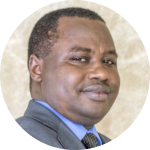 |
Emmanuel Nkurunziza, Director General of the Regional Centre for Mapping of Resources for Development (RCMRD)Dr. Emmanuel Nkurunziza is the Director General of Regional Centre for Mapping of Resources for Development (RCMRD) – an intergovernmental organization with 20 contracting Member States in Eastern and Southern Africa. He took up this position early this year after an 8 year tenure as the Director General of Rwanda Natural Resources Authority, a position he held concurrently with that of Chief Registrar of Land Titles. Dr. Nkurunziza provided the technical and strategic direction to the development and implementation of Rwanda's land reform programme that managed to bring all land in the country under registered title and established a modern land administration system. The titling programme in Rwanda pioneered full-scale implementation of what are now generally referred as fit-for-purpose land administration techniques and approaches. Dr. Nkurunziza's academic background is in Land Surveying but holds a masters degree in Urban planning from the University of Wales (Cardiff) and PhD in Public Policy from the University of Birmingham (UK). He began his career in the academia, having worked in various roles as Research Fellow and Lecturer in the Universities of Makerere (Uganda) and Birmingham (UK). He has undertaken research and published on urban land delivery systems as well as livelihoods. |
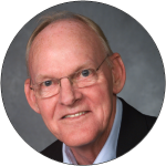 |
Stig Enemark, Honorary FIG President, Senior Consultant and Professor Emeritus of Land Manaement, Aalborg University Denmark.Stig Enemark is Honorary President of the International Federation of Surveyors, FIG (President 2007-2010). He is a Senior Consultant and Professor Emeritus of Land Management, Aalborg University, Denmark, where he was Head of School of Surveying and Planning for 15 years. Before joining the university, he was a licensed surveyor in private practice. He is a well-known international expert in the areas of land administration systems, land management, and spatial planning, and related issues of education and capacity development. He has consulted and published widely within these areas. For a full list of more than 400 publications. |
 |
Amy Coughenour, CEO of Cadasta FoundationAmy Coughenour, CEO of Cadasta Foundation, oversees a global team advancing land and resource rights. Cadasta has grown its impact to over 5 million people with 77 partners in 36 countries. Amy was the COO of International Programs at the National Cooperative Business Association-CLUSA, leading the resilience, food security, and cooperative portfolio in 20 countries. Amy was Deputy Executive Director, Pan American Development Foundation; Deputy Director of the Americas Program, Center for Strategic and International Studies; and has held senior roles and board positions in various social sector organizations for three decades. She holds an M.A. in International Policy Studies from the Middlebury Institute of International Studies and a B.A. in German from Central College |
 |
Jaap Zevenbergen, Head of Department of the Urban and Regional Planning and Geoinformation Management University of Twente ITC FacultyJaap Zevenbergen is Head of Department of the Urban and Regional Planning and Geoinformation Management department of the Faculty ITC of the University of Twente. He studies and consults on cadastral and land (information) management issues, and capacity development on those topics, in a wide range of countries. He has (co) supervised 25 completed and 12 ongoing PhD studies, and acted as external examiner to almost 50 others. He currently is the Editor-in-Chief of the journal Land Use Policy and is (co)author of 100 peer reviewed papers in the field. He served and serves on several boards within the land sector, currently of the Land Portal Foundation, and before of Cadasta Foundation and Global Land Tool Network. He studied both land surveying and real-estate law in the Netherlands and combined the two in his PhD study on systems of land registration, during which he got involved in early cadastral projects in Eastern Europe, while also consulting on Dutch projects linked land information management. More recently the focus has been mainly in Africa, as well as in South-East Asia and Latin America. |
 |
Greg Scott, Inter-Regional Advisor, UN-GGIM Environment Statistics and Geospatial Information Branch United Nations Statistics Division Department of Economic and Social AffairsGreg Scott joined the United Nations Statistics Division in 2012 with the specific task of establishing the United Nations Committee of Experts on Global Geospatial Information Management (UN-GGIM) and growing its relevance and status with Member States and related International Organizations involved in national, regional and global geospatial information management. In his role as Secretariat, Greg provides strategic policy advice and leadership, and guides the development, coordination and implementation of the substantive content for the Committee of Experts. Greg previously spent 25 years in Geoscience Australia in several key roles delivering Australia’s national topographic mapping and derivative geospatial programs, and providing independent scientific analysis and advice in the use of geospatial information for environmental management, emergency management, and critical infrastructure protection. Greg possesses formal qualifications in Cartography and Survey Mapping from New Zealand, a Graduate Diploma in Geography from the Australian National University, and a PhD in Geomatics Engineering from the University of Melbourne. |
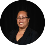 |
Rosamond Carter Bing, Chief Executive Officer for the Ministry of Lands and Natural Resources for the Government of the Kingdom of TongaIn her role as Chief Executive Officer, Ms. Bing is
responsible for the executive oversight of six divisions –
leadership and policy, land administration, surveying is
responsible for the executive oversight of six divisions –
leadership and policy, corporate services, land administration,
survey services, natural resources, land and geographical
information systems and the national spatial planning office. Ms. Bing’s interests are in constitutional and administrative law and natural resources management. |
 |
Anders Sandin, Director, Lantmäteriet The Swedish mapping cadastral and land registration authorityAnders Sandin is managing the Geodata Division within Lantmäteriet. This involves managing the cooperation between Lantmäteriet as the main government body and the Swedish municipalities at the local level. The division also has the overall responsibility of the National Spatial Data Infrastructure NSDI and the contribution to the Swedish implementation of INSPIRE. Mr. Sandin is an advisor to the chairman of the Swedish Geodata Advisory Board. Mr Sandin has a Bachelor of Science from the University of Gävle. On an international level Mr. Sandin has been representing Sweden and Lantmäteriet in the establishment of the United Nations initiative on Global Geospatial Information Management (UN-GGIM): Europe. He has also been engaged in the work with UN-GGIM since 2013 on a global level, and as member of the Working Group on Geospatial Information and Services for Disasters since it was established. He has also been engaged in the work with Integrated Geospatial Information Framework (IGIF) and he is now one of the co-chairs in the UN-GGIM High Level Group IGIF. |
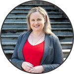 |
Narelle Underwood, Surveyor-General of NSW, AustraliaNarelle Underwood was appointed the 25th Surveyor-General of NSW in 2016 - the youngest person in over 200 years and the first female to hold the position. A major role within State Government she is responsible for the leadership and regulation of the land and mining surveying profession and plays a key advocacy role in the geospatial industry. Leading a team of 70 she is responsible for delivering technical projects, policy and legislation and digital transformation. She is the president of the Board of Surveying and Spatial Information (BOSSI), Chair of the Geographical Names Board (GNB), and the NSW Surveying Taskforce Working in a profession where the average age is 52 and women account for only 3%, Narelle is passionate about women in leadership and improving the diversity of her profession and other STEM based careers. As a Superstar of STEM and brand ambassador for the Get Kids into Survey program, she is working to increase the public visibility of women in STEM to encourage the next generation, including the promotion of surveying in schools. She is also an energetic mentor for young professionals. |
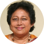 |
Chitra Weddikkara, Dean, Colombo School of Construction Technology Colombo SrilankaAs Managing Director of Q Serve Pte Ltd .Professor Chitra Weddikkara’ contribution to the construction sector is remarkable and counts well over 40 years of experience in the design and the construction industry both in Sri Lanka and abroad. Her professional experience encompasses fields of Architecture, Quantity Surveying, International construction Management Dispute resolution, Construction auditing, Loop hole Engineering, Risk management, value Management, Project management and Claims preparation. She also works as an Arbitrator, Adjudicator and is a member of number of Government advisory bodies in Srilanka She was also a member of National Procurement Commission. Currently she is the Dean of the Colombo School of Construction Technology (CSCT) During her services as the Dean of the Faculty of Architecture in the University of Moratuwa she successfully established a unique identity for the Department of Building Economics of the University. Her academic direction helped earning accreditation among reputable professional bodies such as RICS, PAQS, and AIQS etc. Being widely traveled in the Europe, Americas, Australasia and the Middle Eastern countries, she is a frequent guest speaker at construction related professional venues. She has received many awards in the construction industry for her contribution in her professional services to the country & abroad. Her contribution as a woman to construction industry is worth recognizing. Apart from the academic & professional expertise, Prof. Weddikkara is the President of Women In-Construction Forum Sri Lanka which was established as an idea of her, in order to network and discuss issues relating to the women in construction sector in Sri Lanka. The main objective is to empower women in construction of all classes from professional, trade and skilled, giving them education in such areas and to provide with opportunities for professional development, education, networking, leadership training, public service and more for the women involved in the field from skilled to unskilled. The WIC-Forum SL, in collaboration with the Ceylon Institute of Builders and Community Concerns an NGO conducted training program in skill training to empower suburban and rural women. |
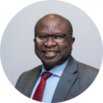 |
Paul Olomolaiye, Pro Vice-Chancellor - Equalities and Civic Engagement at Univercity of the West of England“I am a Professor of Construction Engineering and Management and currently Pro Vice-Chancellor for Equalities and Civic Engagement at UWE Bristol. I Chair the Cabot Learning Federation - a Multi-Academy Trust of 21 Schools in and around Bristol, and a Non-Executive Director of Avon and Wiltshire NHS Mental Health Trust. I hold a PhD from Loughborough University in Civil Engineering and widely published with over 200 journal and conference publications and authorship of 2 major books on Construction Productivity and Stakeholder Management. I am passionate about the experiences of the more than 3000 staff and 30000 students at UWE-Bristol and our collective responsibility as a Civic University in our region and beyond. I am happily married with 3 grown-up children and active in the community in various charitable activities and organisations.” |
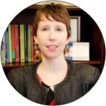 |
Victoria Stanley, Senior Land Administration Specialist at World BankMs. Stanley is a Senior Land Administration Specialist at the World Bank. She has worked in more than 20 countries across Africa, Eastern Europe, Central Asia, and Latin America. She has worked across a wide range of land issues including land reform, administration, governance and policy. She also has experience in the areas of rural and municipal development, gender analysis and inclusion, information technology, public service delivery, institutional reform, and strategic planning and budgeting. Prior to joining the World Bank Ms. Stanley worked for several NGOs on research and development issues, and for the US Department of the Interior in administration and budgeting. Ms. Stanley has a Master of Public and International Affairs from the University of Pittsburgh Graduate School for Public and International Affairs and a Bachelor of Arts from Cornell University. |
 |
Chair: Diane A Dumashie, FIG Vice President; Director Dumashie Ltd; Trustee Lionheart Benevolent Fund.Dumashie Ltd was established to support public sector client organisations in the UK, Africa and Caribbean in complex projects involving land management, spatial planning and economic development. Helping clients to frame those difficult conversations, Diane coordinates and delivers strategic projects that have a clear social, economic livelihood agenda linked to land. Accredited to CEDR, Diane also mediates public and privates sector disputes UK projects involve managing land and infrastructure regeneration schemes. Internationally Diane is an independent and innovative country project leader increasingly oriented to institutional development and training, she has undertaken consultancies for UN Habitat, World Bank, the Commonwealth Secretariat, and partnered with FAO. An expert in the areas of African land issues her work has seen her involved with Ministries in Ghana, Mozambique, Tanzania/Zanzibar and Kenya and establishing and operating a pan- African FIG Regional Capacity Development Network, working with land professionals across fourteen African countries. A passionate ambassador of societal equitable access to land and resources, Diane has led on gender equality initiatives and land tools. In 2012 Diane established ‘Leadership 4 Change’ dedicated to designing and facilitating participatory knowledge transfer programs to assist African professionals. She holds a Doctorate in Land Policy Planning & Integrated Coastal Area Management; bringing together the needs of coastal communities, economic and industry users and physical dimensions |
 |
Frank Tierollf, Chair Executive Board KadasterFrank is Chairman of the Executive Board of the Netherlands’
Cadastre, Land Registry and Mapping Agency, in short: Kadaster.
His focus is to position and represent Kadaster at national and
international level. Main areas of responsibility are Strategy
and Policy, Finance and Governance, Human Resources and Facility
Management. He is a promoter of Kadaster as a partner in the GEO
sector and emphasizes the relevance of innovation. Frank is a
strong ambassador of partnerships between the academic, private
and public sector. |
 |
Sisi Zlatanova, Professor, Head of GRID, Faculty of Built Enviroment, UNSW SydneySisi Zlatanova is a professor and head of GRID at the Faculty of Built Environment, UNSW Sydney. Sisi has been conducting research in many aspects of 3D geoinformation: data representation, structuring, analysis and BIM/GIS integration. Her recent research concentrates on 3D Indoor modelling and navigation. She is author and co-author of more than 400 papers and 23 books. She has been involved in the work of several internationa organisations. She is the president of ISPRS TC IV on Spatial Information science, the treasurer of UDMS and a co-chair of OGC SWG IndoorGML. |
 |
Noud Hooyman, Chief Geo-information Officer Directorate for Spatial Planning Ministry of the Interior and Kingdom Relations NetherlandsNoud Hooyman studied applied mathematics and information
technology at the Technical University of Delft, the
Netherlands. Until recently he was head of the department for
geo information within the Ministry of the Interior and Kingdom
Relations (Home office), which is the coordinating Ministry in
the field of geo information in The Netherlands. At the moment
he is the chief geo-information officer and therefore
responsible for the development of geo-information policies in
The Netherlands. |
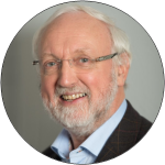 |
Henk Scholten, Director Research and Innovations Geodan NetherlandsProfessor dr. H.J. Scholten is co-founder and Director
Research and Innovations at Geodan, one of the largest European
companies specialised in Geospatial Information Technology.
Professor dr. H.J. Scholten has studied Mathematics and Geography at the Vrije Universiteit Amsterdam and obtained his Ph.D. on the subject of models for housing allocation at the Faculty of Geography of the University of Utrecht in 1988. He has edited or authored numerous books on different aspects of GIScience and published over 100 book chapters, journal papers and other publications. He has supervised 15 PhD dissertations and numerous MSc theses. In his role as director of Geodan, professor Scholten has been supervisor on a large number of national and international GIS projects and has been advisor for several ministries in different countries. Since 2017 professor Scholten is Lead Scientist at the Joint Research Centre (JRC) to develop novel CAS (Centre for Advanced Studies) projects on Digital Transformation – Machine Intelligence and Human Behaviour. In this function, he establishes project plans contributing to high profile scientific results. He was honoured in 2016 with the Lifetime Achievement Award by Geospatial Media and Communications for his contribution to the overall development of GIS/geospatial community worldwide. In 2015, he received the title of honorary Doctor of Science from the Manchester Metropolitan University for his extensive contributions to GIS. Professor Scholten received in 2009 the ‘Lifetime Achievement Award’ by Jack Dangermond, founder of ESRI. This award is given to a person who has contributed significantly to advancing the science and technology of GIS throughout his career. In 2005, professor Scholten received a Royal Decoration for his significant contribution to geo-information, both on a national and international level. |
 |
Jan Bruijn, Condultant at GeonovumJan Bruijn is director at SVB-BGT, the foundation of source-holders of the Key Register of Large Scale Topografy. In the past eight years he led the transition of 400 sourceholders to build and maintain this Key Register in collaboration with geobusiness. By this year Jan founded Nest4Innovation to bring knowledge and people together to work on innovative concepts and build partnerships and teams to make innovation happen and create business value. Last Year he worked at Geonovum with a team on the proposal for a National Infrastructure of Digital Twins in collaboration with the triple helix. Jan Bruijn studied information technology at the Technical University of Twente and obtained a Master in Business Administration at the Twente School of Management. |
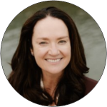 |
Katriona Lord-Levins, Chief Success Officer, SVP at BentleyEnabling proven, strategic business outcomes through people, process and technology. Kat leads User Success and Education at Bentley Systems with a relentless focus on creating loyal users by helping them realize their business value, making Bentley their solution of choice. Kat has a solid track record of building and running world class success organizations through a very hands-on approach to engaging and leading teams. Before joining Bentley, she worked for two decades at Autodesk in several roles, including, most recently, focusing on building and leading the construction business unit customer success team. Prior to Autodesk Kat worked at Alias Research in Toronto, a software company that produced high-end 3D graphics software. Kat earned a degree in computer science from the University of Toronto. |
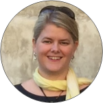 |
Paula Dijkstra, Director a.i. of Kadaster International - co-conference director e-Working Week 2020As Director a.i. of Kadaster International Paula is responsible for the coordination of Kadaster’s international activities and international cooperation projects. Kadaster International provides worldwide advisory services in the domain of land administration, e-governance, geo-information services and SDI. Paula is working for the international department since 2011. She obtained a Master degree in Social Geography and a grade in cadastral data acquisition and 3D modelling. In addition to the above Paula has been appointed as the co-conference director for the e-Working Week of the International Federation of Surveyors (FIG) hosted by the Netherlands and originally planned in 2020 (postponed to 2021 due to COVID-19). She is also chair of the FIG taskforce on the Sustainable Development Goals, as well as Working Group 7.2 on Fit For Purpose Land Administration Implementation. Louise Friis-Hansen, FIG Director |
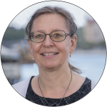 |
Louise has worked for FIG since August 2009. With a background as MSc in Economics and Business she loves and appreciates working together with surveyors from all over the world which is inspiring, rewarding, very instructive – a whole new and exciting world has opened up - and also time consuming! The international environment has always been an inspiration with longer stays in both Germany and the US and previous International experience such as organising larger international events e.g. MBA Fora. Louise has previously worked in an organisation for Business Economists and is used to working with volunteers and was during her studies also volunteer in the same association; for other organisations she has worked with market analyses, organising further education in leadership and management, has an extra degree in web-writing and editing, and has for several years been web-editor before starting working in FIG. |