W.A. (Bill) Robertson
Introduction
The New Zealand survey system is at a watershed in terms of its future direction and development. On the one hand there are pressures to become more efficient, driven by economic and financial requirements of both the public and private sectors; while on the other hand the opportunities to make improvements are coming of age. Technology, creative ideas and willingness to change will enable us to make significant progress, if we choose to take advantage of them. The challenge is to manage the opportunities to make effective progress.Failure to reform may well result in the erosion of the NZ survey system through increasing obsolescence.
I have been concerned for some time that the window of opportunity was opening and that the opportunity could be missed if not grasped at the right time. One of the aims of DOSLI's (Department of Survey and Land Information) restructuring is to facilitate the management of the Survey System infrastructure and its development. The role of the survey industry is also important as the acceptance and success of any major developments will depend upon all participants in and users of the system being consulted and involved in the change program.
Background
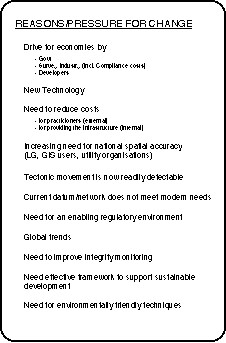
New Zealand has a Survey System with good parcel dimensions although coordinates not on the geodetic datum are inconsistent. Early on in colonisation a good triangulation system was designed and this culminated in a national triangulation defining the geodetic datum. The innovation of chaining in catenary in the late 1860s has meant the maintenance of a high accuracy of parcel dimensions throughout this century. However the geodetic triangulation was not trilaterated with EDM and GPS is now showing up comparative inaccuracies. The 1949 Geodetic Datum took 30 years to complete. However 3 months work with GPS has now re-observed 2/3 of this providing a drastic example of the time savings of new technology.
Aims of the Development
The aims for the development of the Survey System are:* To reduce the cost (to users and to Government) of providing the infrastructure).
* To reduce the cost (to practitioners) of carrying out surveys.
* To improve efficiencies throughout the system.
* To improve the quality of products and services to the survey industry and other users.
* To provide quality databases.
Implied in these aims is the desire to automate processes as much as possible.
Progress to Date
Some projects which will make improvements to the system are already under way as part of my department's effort to provide products which clients require. However, these projects were originally identified and set up under their own merits rather than as part of a managed and coordinated plan.The completion of the first stage of DOSLI's restructuring enabled a managed approach to be taken to coordinate existing projects and identifying possible new projects. These have been identified and a number of developments are already under action.
The approach we have taken is to use advanced generic management techniques to plan the overall reform and then to manage the projects as a total program using project leading management techniques.
Vision and Mission
A Task Force has been set up within DOSLI to help manage the program and its vision mission and terms of reference have been identified as:The vision is: A survey system which enables the growth and development of New Zealand by providing a quality spatial infrastructure to support secure land tenure rights, and resource use and management.
The mission is: To enhance the quality and delivery of spatially referenced information to meet the needs of the nation.
Terms of Reference:
1. To develop policy and strategic direction of the Survey System development to achieve the vision and mission statements.
2. To periodically review the vision and mission statements.
3. To work in partnership and provide a forum for exchange of information with all bodies identified in the Survey Act and all participants in the survey industry.
4. To investigate and recommend effective application of technology and systems to meet the objectives of the survey system.
5. To provide the strategic management (identify, prioritise, integrate, coordinate and monitor) of projects which comprise the survey system.
6. The task force is accountable through the Group Manager, Survey System to the Surveyor-General and, where appropriate, to the Survey Board.
The Parallel Plan
The development of the survey system will include and incorporate a wide range of activities and development projects. Some parts of the system are undergoing change and improvement on an almost continuous basis while other parts are facing imminent change of pressure to do so.There is a high degree of urgency to make changes in some areas before it is possible to have an overall 'grand plan' prepared and approved. However, without a clear direction we face the prospect of a disjointed, uncoordinated and high-risk approach. The solution to this problem is to take a 'parallel approach' to the development. Two levels will be simultaneously attacked:
- At the conceptual and visionary level an outline vision will be described and developed on an iterative basis, improving and evolving as more detailed and wider input is received. The components of this level are the vision statement, mission statement and a statement of design concepts.
- At the project level the project briefs and scoping will provide the direction for projects already under action or about to be introduced.
Therefore, with projects under way, we will be continuing to develop the vision, mission and design concepts; updating them as we gain experience and receive new ideas. Some long-term projects may have to be realigned to meet evolving concepts, though a careful approach is required to ensure that there is no waste of effort. Project planning will take these issues into account.
Projects
Projects which are seen as having high impact on the industry are (unprioritised):* A spatially-accurate survey database
* Computer access the survey index (DCDB)
* "Electronic plans"
* Plan tracking and monitoring (during processing)
* Automation of survey plan examination
* Unified code of practice
* Quality assurance
* Rewriting of survey regulations
* Geodetic Datum investigation
* Future survey techniques
* Document imaging system
* Survey control network design
A separate but fully integrated project is the automation of the title system.
Cadastral Conference
A New Zealand / Australia cadastral conference is being arranged, to be held in Wellington, New Zealand 14 - 16 June 1995. It is hoped that the sharing of ideas and innovation will enhance the development program.Our aim is to plan for a completely digital automated spatial data environment operating in the year 2005 at the end of our second decade of transition.
Speaker: W.A. (Bill) Robertson Tel. +64-4-473 5022
Director General Fax
+64-4-472 2244
Dept. of Survey & Land Information
Charles Fergusson
Building, Bowen Street
Private Box 170
Wellington
NEW ZEALAND


Maintainer : David Mercer - webmaster@fig7.org.uk Last Modified: September 1996.