Joint Board of GIS
|
The Value of Geoinformation for Disaster and Risk Management (VALID)
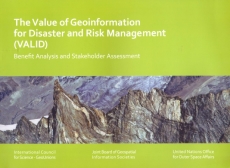 |
The Value of Geoinformation for Disaster
and Risk Management (VALID) - Benefit Analysis and
Stakeholder Assessment is published by the Joint Board
of Geospatial Information Societies (JB GIS). The
publication is the result of the collaboration of many
scientists who are dedicated to the implementation of geospatial
information for Disaster and Risk Management. |
Download the report
(9.85 MB)
In July 2010, the Joint Board of Geospatial Information Societies
(JBGIS) and UNOOSA/UN-SPIDER published ‘Geoinformation for Disaster and
Risk Management – Examples and Best Practices’, a compilation of case
studies that provides information on what can be done with
geoinformation in support of disaster and risk management including
methods, systems, applications, and experiences. As a next logical step,
a second project called "The Value of Geo-Information for Disaster and
Risk Management (VALID) - Benefit Analysis and Stakeholder Assessment"
was carried out with the goal of offering complementary information
about the value of geoinformation – an evaluation of benefits. A
publication to that end would further help to raise awareness in the
political and programmatic
environment and to contribute to setting priorities in research and
development.
Objective: The intention of this second project of JBGIS and UNOOSA
was to produce a publication to illustrate the economic, humanitarian
and organizational benefits which can be realized by applying
geoinformation to disaster risk management, based on analyses of
representative cases, and on an expert stakeholder assessment.
Two-fold approach: Two complementary methods were applied in this
project in order to ensure a holistic view on the benefits of
geoinformation for disaster management and best possible coverage of the
disaster management cycle.
Socio-Economic Benefit Analysis: In a classical Cost-Benefit-Analysis
the costs of an investment were compared with the monetary value of
societal and economic benefits generated thereby. Whereas the costs of a
given geoinformation product can be easily estimated by any geodata or
GIS provider, monetizing its societal benefit is more complicated and
fuzzy. A Call for Papers was issued, addressing the scientific community
in the field of socio-economic research on disaster management.
Contributions were based on analyses of real disaster cases rather than
on theoretical approaches.
Expert Stakeholder Assessment: A reference set of different geodata
product descriptions was identified and distributed to a group of
potential users (practitioners as well as planners and decision-makers,
affiliated to public disaster management bodies, international
organizations and NGOs), together with a template for product appraisal.
This template specified a list of criteria related to various aspects of
benefit. Based on a normalized rating schedule, the experts evaluated
all reference products according to the beneficial impact which can be
attributed to their application. The outcome is a differentiated
evaluation of benefits, which can be supplemented by a cost estimate of
its implementation.
http://www.un-spider.org/sites/default/files/VALIDPublication.pdf


