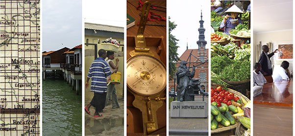
FIG represents the interests of surveyors worldwide
FIG was founded in 1878 and is a United Nations and World Bank recognized non-governmental organization of national member associations, cadastral and mapping agencies and ministries, universities and corporates from over 120 countries. FIG covers the whole range of professional fields within the global surveying community, hereunder surveying, cadastre, valuation, mapping, geodesy, hydrography, geospatial, and quantity surveyors and provides an international forum for discussion and development aiming to promote professional practice and standards.
Learn more…       r

Major FIG Conferences

www.fig.net/fig2023
Call for papers
Register now


Accra, Ghana 19-24 May

www.fig.net/fig2024


FIG Congress 2022

www.fig.net/fig2022
Proceedings

Library

FIG Publication No. 80

FIG Publication no. 80 - FIG Guide: Digital transformation and land administration - Sustainable practices from the UNECE region and beyond, published by FAO, UN and FIG

Throughout the COVID-19 pandemic, the FAO, UNECE and FIG fostered dialogue between countries using webinars to capture experiences and the key lessons. That knowledge forms the basis for what is presented here. The publication delivers country- level perspectives using case materials drawn mainly from the UNECE region. Read more...

FIG Publication No. 79

FIG Publication no. 79 - FIG Report: Land Consolidation - The Fundamentals to Guide Practice

This publication is published by FIG Commission 8 Land consolidation is a specialised land policy instrument, which has already been on the agenda within the FIG community for a long time. Now, we decided to bundle the available international experiences, insights, and knowledge into a FIG publication. It is my great pleasure to present this land consolidation publication to you. Read more...

FIG Publication No. 78

FIG Publication no. 78 - FIG Report: Geospatial Data in the 2020s - Transformative Power and Pathways to Sustainabililty

This Commission 3 publication sheds light on several areas where geospatial data can be particularly useful in supporting the path to sustainability in the 2020s, for spatial land use planning and health monitoring, with data collection through voluntary geographic information, with attention to diversity and inclusion, and by providing information on property, including property values Read more...

FIG Publication No. 77

Good Practice for Resilience Planning to Address Water Governance Challenges in Africa

FIG Commission 8 - Spatial Planning and Development, Working Group 8.5 on African Water Governance FIG Report 2021
Read more...

FIG 2022 Proceedings

"Volunteering for the future - Geospatial excellence for a better living” FIG Congress 2022 Proceedings

FIG Peer Review Journal

Since 2008 it has been possible to offer a conference paper for a peer-review, an opportunity that about 10% of presenters take advantage of. The accepted papers that have been presented at a major FIG conference are included in the FIG Peer Review Journal.
Visit FIG Peer Review Journal

FIG Surveyors Reference Library

The library is a short cut to all papers from FIG Congresses, Working Weeks and other FIG events, as well as so-called recommended papers that are specially selected by the ten FIG commissions. Read more...

Most Recent News
Enhancing Surveying Education through Blended Learning

A new FIG Publication has been published - no 81 including guidance on good practices in implementing blended learning in surveying education...

Digital Transformation for Responsible Land Administration

FIG Commission 2 and 7 are inviting to their annual meeting 2-4 October 2023 in the Netherlands. Read more about the event...

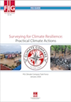
Join a Global Climate Community

Several sessions at the FIG Working Week are around climate. Join the special session organised by the Task Force and see the other sessions  ...

FIG Mentoring Programme for Africa - 2023

FIG Africa Regional Network and FIG Young Surveyors are happy to announce the 2023 FIG Mentoring Programme for Africa that will run between Ju...

FIG General Assembly 2023- Agenda

The 46th FIG General Assembly will include the Work Plans of FIG Council and Commissions, four new task forces, and two member associations have submitted bids for the FIG Working Week 2027.

Platinum Corporate Members


FIG is dedicated to promote the SDG’s
See how

What is VCSP?

... the Volunteer Community Surveyor Programme
Learn more

Latest Releases

> History of Surveying
> FIG Pub 78 - Geospatial Data in the 2020s
> FIG Pub 79 - Land Consolidation
> FIG Pub 80 - Digital transformation and land administration
> FIG Pub 81 - Enhancing Surveying Education through Blended Learning


Meeting the President General Assembly 2023

Dr. Diane Dumashie was elected President at the General Assembly in September 2022

 Get to know Diane...


Diane Dumashie answers questions about the surveying profession in GIM Magazine September 2022  Read more.

The General Assembly will take place in Orlando, Florida, USA on 28 May and 1 June 2023. The new council work plan will be presented as well as the plans for the commissions and networks for this term. There are two candidates for the destination for 2027, one new honorary member nomination, one honorary president nomination and much more.

Council Work Plan for the term 2023-2026.

FIG Members Article of the Month

FIG has five different levels of membership and two levels of honorary membership. Through different membership categories 121 countries are represented in FIG. The membership categories are:

- Member Associations
- Affiliates
- Corporate Members
- Academic Members
- Correspondents
- Honorary Presidents
- Honorary Members

Members

FIG publishes each month the FIG Article of the Month. This is a high-level paper focusing on interesting topic to all surveyors.

The article of the month in May 2023 is a recording of the FIG Congress 2022 Keynote: Mapping the Plastic. Gordana Jakovlejvic and Simon Ironside speak about plastic pollution and the process that will enable the accurate mapping and classification of floating plastic. Learn more about their developed world leading methodology to accurately extract floating plastic data (as small as 1.0 cm in length) from multi-spectral UAV images using artificial intelligence deep learning algorithms.

Read the article