| |
FIG PUBLICATION NO. 85
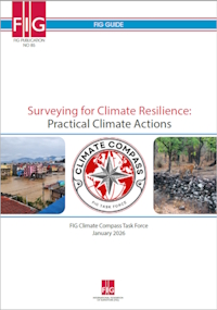
Surveying for Climate Resilience: Practical Climate Actions
FIG GUIDE
FIG Climate Compass Task Force
January 2026
Author and Coordinator:
Clarissa Augustinus
Contributing Authors:
Uchendu Eugene Chigbu, Charisse Griffith-Charles, Simon Ironside,
Eranda Gunathilaka and Rigoberto Moreno Vazquez
Supported by:
Angela Anyakora, David Elegbede, Naa Dedi Tagoe, Cromwell Manaloto,
Enrico Rispoli, Maria Scorza, Simon Ironside and Rigoberto Moreno
Vazquez.

FOREWORD
By Diane Dumashie,
FIG President (2023-2026)

|
The world stands at a pivotal moment in its collective response to
the climate crisis as a present and accelerating reality. Within
this context, the International Federation of Surveyors (FIG)
publication Surveying for Climate Resilience: Practical Climate
Actions – spanning land, water, and marine surveying – highlights
the essential role of surveying professionals in advancing climate
resilience.
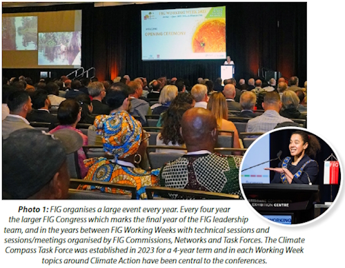
Climate action is a central pillar of the FIG Work Plan 2023–2026 and is
deeply aligned with the FIG Vision to “serve and leave no one behind.”
Sustainability alone is no longer sufficient; resilience must now be
embedded in all aspects of our professional practice. As surveyors, we share
a responsibility to strengthen knowledge, build capacity, and support people
and the planet. It was with this purpose that FIG established the Climate
Compass Task Force – to guide our collective efforts and chart a clear path
forward.
|
The scale and complexity of the climate crisis demands that surveyors
demonstrate courage, leadership, and a commitment to developing practical,
knowledge-driven solutions that enable communities everywhere to thrive.
This publication, led by the FIG Climate Compass Task Force, is the product
of extensive collaboration across continents, disciplines, and generations
and reflects the collective wisdom and commitment of the global survey
community.
With its 16 highlevel Climate Actions, this publication marks a
significant milestone for FIG. Building on earlier climate publications, it
offers practical strategies and realworld examples to support climate
adaptation, mitigation, and disaster resilience at national and local
levels. Much of the content draws from the rich discussions and technical
papers presented during the FIG Working Weeks from 2023 to 2026. Including a
significant contribution from the Call to Action on Climate Responsible Land
Governance and Disaster Resilience (2024, Nepal Regional conference).
The evidence is clear: surveyors are on the critical path to delivering
climate resilience globally, nationally, and locally. Our profession’s core
strengths – precision, integrity, and a commitment to authoritative data –
are more vital than ever as we confront the escalating impacts of climate
change.
Digital technological innovations are reshaping how surveyors collect,
manage, and interpret data, providing insights for climate action and
helping to bridge the digital divide between the Global North and South. Yet
embracing these technologies brings responsibilities: upholding ethical
standards, protecting data sovereignty, and respecting Indigenous and local
community rights. The profession is also evolving within emerging climate
resilience markets, such as by the integration of climate data with land
administration systems and developing interoperable platforms for informed
responses. Surveyors’ contributions – such as redesigning geodetic and
hydrographic infrastructure and advancing scenario modelling – are vital to
ensuring that systems remain fit for climate resilience.
These evolving roles demand new ethical standards and protocols. As
experts in the relationship between land and people, surveyors play a
critical role in safeguarding land rights – particularly for vulnerable
populations – while supporting adaptation and mitigation strategies. This
involves making informed judgements on rights, restrictions, and
responsibilities, with a renewed commitment on fairness and equity. Meeting
these challenges requires expanding the workforce, fostering
interdisciplinary collaboration, and empowering young and diverse
professionals to lead future efforts.
I extend my sincere appreciation to all who contributed to this publication.
I express my deepest gratitude to Dr Clarissa Augustinus, Chair of the
Climate Compass Task Force, who served as lead author and coordinator. Her
leadership, together with the dedication of the Task Force team and the many
reviewers whose insights covering the many aspects of surveying and drawn
from every region of the world, has ensured that this guidance is both
globally relevant and locally actionable.
The future we seek is one that fully supports the United Nations
Sustainable Development Goals – advancing People through responsible land
governance, strengthening Partnerships from global to local, promoting Peace
through equity and human rights, protecting our Planet from the impacts of
climate change and natural disasters, and enabling Prosperity through
resilient land and property systems.
Let this report serve as both a call to action and a source of
inspiration to the global FIG community. Together, we can harness the power
of surveying to build a more resilient, equitable, and sustainable future
for all.
Executive Summary
Purpose and approach: The purpose of this FIG
publication has been to identify some of the key surveying actions, methods
and tools for climate resilience, for land, water and marine environments,
for people, economic growth/poverty reduction and the planet. FIG papers,
presentations at conferences and Climate Compass Task Force webinars were
the main source of information for this publication. They also informed the
choice of the 16 Climate Actions highlighted. Prominent surveyors in the
profession gave detailed comments on advanced drafts and supplied overall
and detailed guidance. This strengthened the publication and confirmed the
major climate resilience roles for surveyors.
Long-term geospatial, hydrospatial and land administration systems data
collection are foundations for territorial governance, in the context of
climate resilience. This data is vital for: climate-related policy
development; long-term climate monitoring and management; and the
identification of risks. It supports planning for: adaptation (adapting to
manage climate impacts) and mitigation (reduction or prevention of
greenhouse gases including carbon); effective land, water and marine
management; and support to decision-makers managing the climate crisis. New
technologies such as geospatial databases, Earth Observation (EO) data,
artificial intelligence (AI) tools, and other spatial and temporal
innovations have made the surveyors’ role critical in the management of
climate impacts. Climate action is becoming an increasingly key feature of
FIG. Sixteen (16) critical Climate Actions are identified in this
publication for surveying for climate resilience.
Definition of climate resilience: Surveying for climate
resilience involves re-designing geospatial data systems, geodetic and
hydrographic infrastructure, database systems and land administration
systems, policies, methods and tools, to address the challenges of climate
change (carbon emissions), biodiversity loss, and land degradation. It
focuses on managing climate impacts, adapting to climate change, and
transitioning to sustainable practices that support carbon emissions
reduction (mitigation) on land, and in water and marine environments. This
will contribute to ensuring resilience for both people and the planet.
Climate crisis, vulnerable people and new business models:
Humanity is dealing with a global climate crisis, with disproportionate
impacts on vulnerable regions, countries and people in the global south. The
most affected populations are often those with insecure tenure, including
smallholder farmers, Iocal communities, informal settlers, women and those
living in disaster prone areas. Surveyors have a major role to play
supporting the adaptation and mitigation of climate impacts at the global,
national and local levels in a way that supports environmental
sustainability, economic growth and the land rights of people. The 17
Sustainable Development Goals form the overarching policy framework for this
publication.
The climate crisis is creating opportunities for surveyors, government,
the private sector and industries to move to new business models that
support climate resilience. To encourage surveyors to develop solutions,
some of the key actions, methods and tools of these business models, across
the digital divide, are described.
New technology, quality assessment, ethics: New and
complex climate challenges can be addressed by embracing new technology. New
technology allows professionals to focus on data interpretation, analytics
and the extraction of meaningful climate related insights, rather than data
handling. Surveyors need to continue to develop, re-design, field test,
innovate, experiment and pilot novel procedures using new technology,
including artificial intelligence (AI), to meet the new demands regarding
climate resilience. Using new technology to support climate resilience
requires new types of ethical judgements and standards.
Government, customers and users: New markets are opening
for surveyors. Customers, users and government will need ongoing support as
they respond to climate resilient market trends, regulatory requirements and
disclosure standards. Government-led climate action involves collaboration
and coordination in a whole-of-government approach to support the delivery
of national environmental goals and plans, where the Lands Departments have
a key role to play.
Education, training and workforce: While some education
and training institutions have already taken up the challenge of educating
surveyors to support climate resilience, much more needs to be done, also
regarding continuing professional development (CPD). Also, immediate efforts
are needed to scale up the workforce to support climate resilience, focused
on the surveyor’s role as data manager, young surveyors and women surveyors.
Land and marine cadastre and data: The climate crisis
has started facilitating the development of innovative fit-for-purpose (FFP)
systems that support climate resilience. FFP land administration systems,
data, tools and methodologies are being re-designed for climate resilience.
Geodetic and hydrographic infrastructure are key to the protection and
management of the marine environment and for strengthening marine cadastres.
Urban and rural areas: Surveying that supports climate
resilience in urban areas needs to address a wide range of issues including:
blue-green infrastructure; urban sprawl into agricultural and natural areas;
affordable housing shortages; large scale climate induced migration to urban
areas requiring increased land; smart land use planning and services; the
rehabilitation and redevelopment of infrastructure after natural disaster
events; and vulnerable informal settlements. In rural areas, climate smart
agriculture, environmentally sustainable land use practices and forest
management need to be supported by surveyors, as land use change is directly
linked to large scale carbon emissions.
Natural disaster and climate-related conflict: Surveying
knowledge and skills are needed to address a wide range of different types
of natural hazards and disasters. Climate-related disasters displace
millions of people every year as their homes become uninhabitable, their
livelihoods unsustainable and their lives at risk in hazard-prone areas. The
land rights of vulnerable people need to be protected. Geospatial and land
administration systems need to be re-designed for the different natural
disaster stages. Climate, conflict and land are often inter-linked. Conflict
can exacerbate climate issues and climate issues can trigger conflict,
including violent protracted conflict. It can cause people to migrate,
compete for land, water and natural resources, and struggle for food
security.
International organizations: Surveyors are asking for
practical examples of climate resilient surveying, rather than policy
directions alone. International bodies who want to engage in climate action
and surveying should take cognizance of this as they work to support people
and the planet.
Overall findings: Surveyors undertake many critical
climate actions, often involving multiple stakeholders. While governments
play the leading role, the private sector, academia, national and
international institutions, training institutions and those industries
building new geospatial data, analytical methods and tools, are also key to
surveying for climate resilience. Climate action involves technology,
governance and people, which in the climate context also means safeguarding
people’s land rights and livelihoods.
To support the climate resilience of people and the environment,
surveyors are adapting professional standards. As new technologies and
processes emerge, quality assessment, testing and developing new data
acquisition tools are key. This is something for which surveyors are well
known and it is vital for sustainability both in terms of system design and
for climate resilience. This also means adopting and adapting AI and machine
learning, guided by the reasoning of surveyors for accuracy. Most
importantly, government-led programmes on climate resilience are critical
for success and scale. As governments strive to meet national environmental,
economic, social and governance goals, surveyors can support decision-makers
to make better decisions. Customers, existing and future, need support as
they include climate adaptation and mitigation in their business models.
To ensure that the surveying industry can do the job, surveying
education, training and continuing professional development needs to be
re-geared along a spectrum from digital literacy to advanced analytics to
support the development of surveying for climate resilience. This is
required so that the work force can upscale and undertake the required
climate actions locally, nationally and for the planet.
All of this work underpins the re-design of the land administration and
geospatial data systems to support climate resilience. Rapid, agile, climate
resilient FFP land administration is needed to support disaster and conflict
risk management. Urban and rural land administration systems are being
re-designed to prevent urban encroachment on adjacent agricultural and
natural areas and agricultural encroachment on natural areas and forests. A
much greater focus is needed on forests than has been traditional among
surveyors.
Significant challenges remain: While this practical
guide draws on case studies, best practices and activity highlights that
show the way forward to support climate resilience, major challenges remain.
There are numerous gaps in actions, tools and methods that need to be
scaled, as only some countries have working solutions. Or the solutions are
only being addressed in some countries in the global north. Or solutions are
context specific and need to be documented and shared to other countries for
domestication. Or they reflect goals still being worked on at country and
local levels. The tools, methods and actions described here need to be
scaled up dramatically within countries and across the world.
The 16 Climate Actions: This publication is structured
in terms of 16 Climate Actions. The first 9 Climate Actions are about the
fundamentals of all professional surveying for climate resilience namely:
Climate Action 1. Professional ethics and standards; Climate Action 2.
People, surveying and governance; Climate Action 3. Testing and developing
new data acquisition tools; Climate Action 4. Increasing technical capacity,
including AI use; Climate Action 5. Quality assessment; Climate Action 6.
Government-led response to climate issues, including local government;
Climate Action 7. Customers and users of surveying for climate resilience;
Climate Action 8. Education, training and continuing professional
development; and Climate Action 9. Scaling up the work force.
This is followed by 6 Climate Actions that focus on types of situations
where surveying for climate resilience would be mainly carried out namely:
Climate Action 10: Rapid, agile, climate resilient fit-for-purpose land
administration; Climate Action 11: Strengthening marine data systems;
Climate Action 12: Re-designing urban and peri-urban systems for climate
resilience; Climate Action 13: Sustainable rural land management; Climate
Action 14: Disaster risk management; and Climate Action 15: Climate,
conflict and land. The final Climate Action relates to international players
namely: Climate Action 16: Role of international surveying bodies.
International Federation of Surveyors (FIG): FIG as a
large international organization covering over 100 countries has made a good
start on branding the profession as playing an important climate action
role. This is demonstrated by the increasing number of climate-related
abstracts being submitted for the annual Working Week or quadrennial
Congresses. This aspect of the FIG brand needs to be strengthened to reach
humanities’ environmental goals faster and at the scale required.
Use of AI: No AI was used to create the contents of this
publication. Readers are however encouraged to use AI to summarise this
publication in terms of their own interests if they have insufficient time
to read the whole publication.
Contents
Foreword
Acknowledgements and Review Process
Executive Summary
1 Introduction: Surveying for Climate Resilience: Practical Climate Actions
2 Surveying Fundamentals and Climate Resilience
3 Focus areas for Surveying for Climate Resilience
4 International Roles
5 Conclusions
Useful References
About Authors
Read the full FIG Publication 85 in pdf
Copyright © The International Federation of Surveyors (FIG),
January 2026.
All rights reserved.
International Federation of Surveyors (FIG)
Kalvebod Brygge 31–33
DK-1780 Copenhagen V
DENMARK
Tel. + 45 38 86 10 81
E-mail: FIG@FIG.net
www.fig.net
Published in English
Copenhagen, Denmark
ISSN 2311-8423 (pdf)
ISBN 978-87-93914-30-8 (pdf)
Published by
International Federation of Surveyors (FIG)
Layout: Lagarto
|