News in 2017

|
5th UNGGIM High Level Forum incl. UNGGIM Subcommittee on Geodesy
26-30 November, Mexico City, Mexico
5th UNGGIM High Level Forum, 28-30 November 2017
United Nations Global Geospatial Information Management arranged in
Mexico City, along with the host organizations in Mexico, the Fifth
High-level Forum. The meeting was held 28-30 November 2017. The purpose
of the meeting was to clarify and reinforce the role of geospatial
innovation and technology on national level and at the national
implementation of the SDG, and to strengthen national capacities,
particularly in developing countries, to implement the 2030 agenda. More
than 70 countries participated and the number of participants was more
than 300.
The High Level Forum is organized with about 18 months apart, and
unlike the annual UNGGIM Committee of Experts meeting that takes place
in New York in August of each year, these meetings are to have more
focused discussions. The focus at this meeting was to discuss geospatial
data, statistics and United Nations Sustainable Development Goal. The
theme of the meeting was Implementing the Sustainable Development Goals:
The Role of Geospatial Technology and Innovation. A total of five
sessions were conducted. A session consisted of a keynote speaker who
got about 20 hours to specialize in, as well as a panel of five speakers
that had 5-10 minutes. The sessions ended with a question and answer
session.
The title of the sessions were
- Session 1: Implementing the SDGs: The relevance of geography and
reliable, timely, accessible and disaggregated data
- Session 2: Geospatial knowledge platforms: Empowering the SDGs
through geographic tools and services
- Session 3: Implementing the SDGs: The role of geospatial
research and innovation
- Session 4: Integrated information systems: A national priority
for implementing the SDGs
- Session 5: Public-private partnerships: Evolving integrated
geospatial knowledge platforms
UNGGIM High Level Forum is one of the formal UNGGIM meetings, meaning
that the UNGGIM secretariat documents as well as facilitating that a
Mexico City Declaration is presented. All documents, including the
declaration, are available on UN GGIMs website (http://ggim.un.org/).
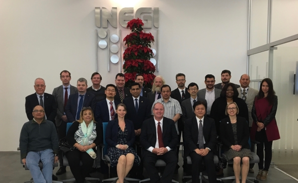
Group photo of the Sub-committee on Geodesy incl FIG
Vice President Mikael Lilje
UNGGIM Subcommittee on Geodesy, 26-27 November 2017
The UNGGIM Committee of Experts endorsed in 2016 the global geodetic
roadmap as a “principle-based briefing document for national
Governments”. They then welcomed the development of an implementation
plan to link the road map recommendations to national policy
developments. To ensure a sustainability regarding the global geodetic
reference frames, the same committee elevated the GGRF working group
(WG) in 2017 to a Sub-Committee on Geodesy (SCoG) to strengthen the
GGRF. At the same time, they requested the development of a position
paper to define the appropriate governance arrangements for the GGRF and
asked that this is to be presented in 2018. In Mexico City the
Subcommittee had its inaugural meeting. FIG is an associate member to
the subcommittee and Mikael Lilje is the contact person. Since FIG is
considered to be good in capacity building, Mikael has also been asked
to lead a focus group on Education, Training and Capacity Building.
Currently there are five focus groups and they are; Governance,
Education, Training and Capacity building, Outreach and Communication,
Geodetic infrastructure and finally Policy, standards and conventions.
The Subcommittee is since the meeting co-chaired by Australian
(2017/2018) and Russian Federation (2017/2019). The current focus within
the subcommittee is to develop an appropriate governance and this will
support the other focus areas.
Mikael Lilje, FIG Vice President
December 2017


